 Contact
Recent Updates
Refer recent projects
Stay in the loop with our latest updates! Explore our recent additions, improvements, and news to keep up with what's happening in our world. From exciting new features to important announcements, there's always something fresh to discover.
-

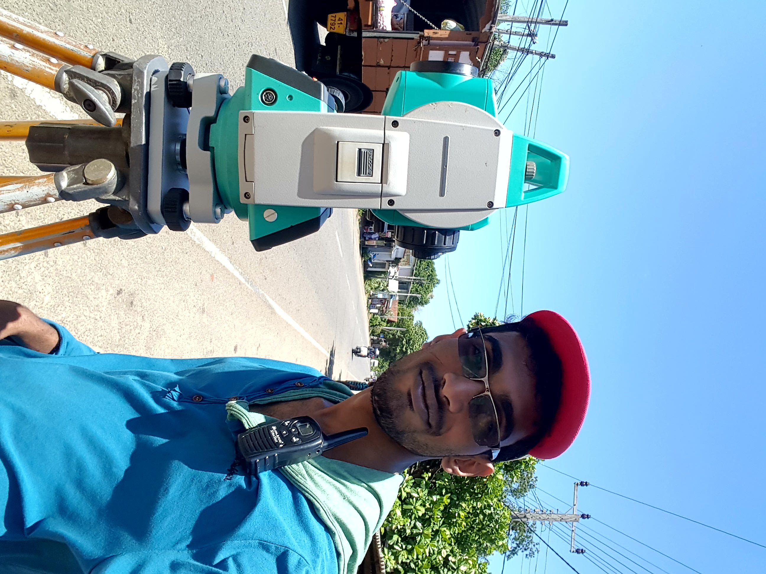
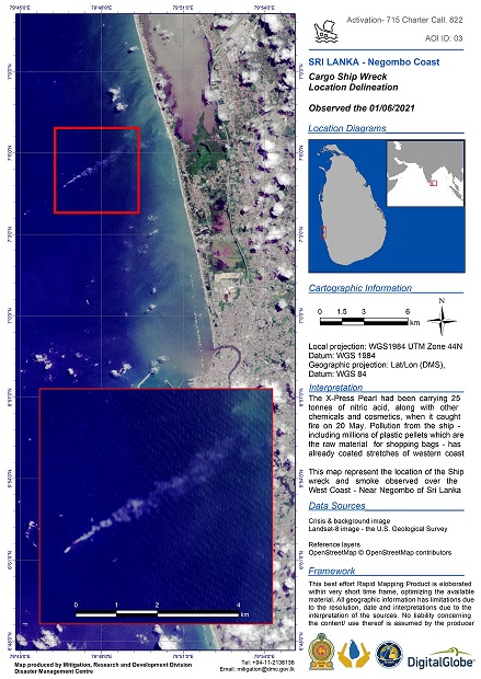
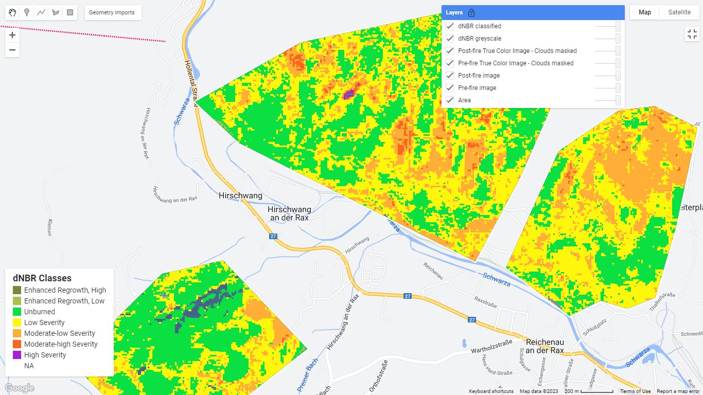
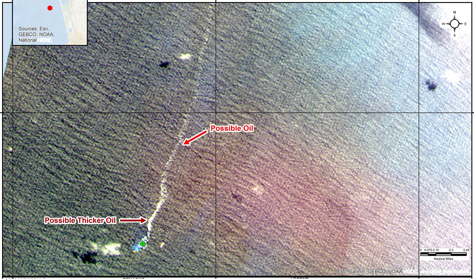
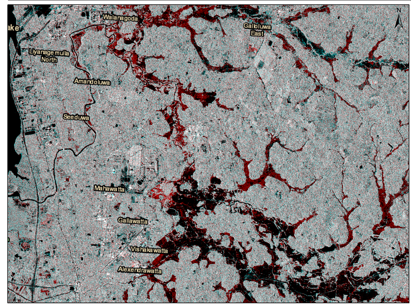
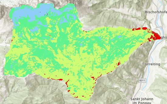
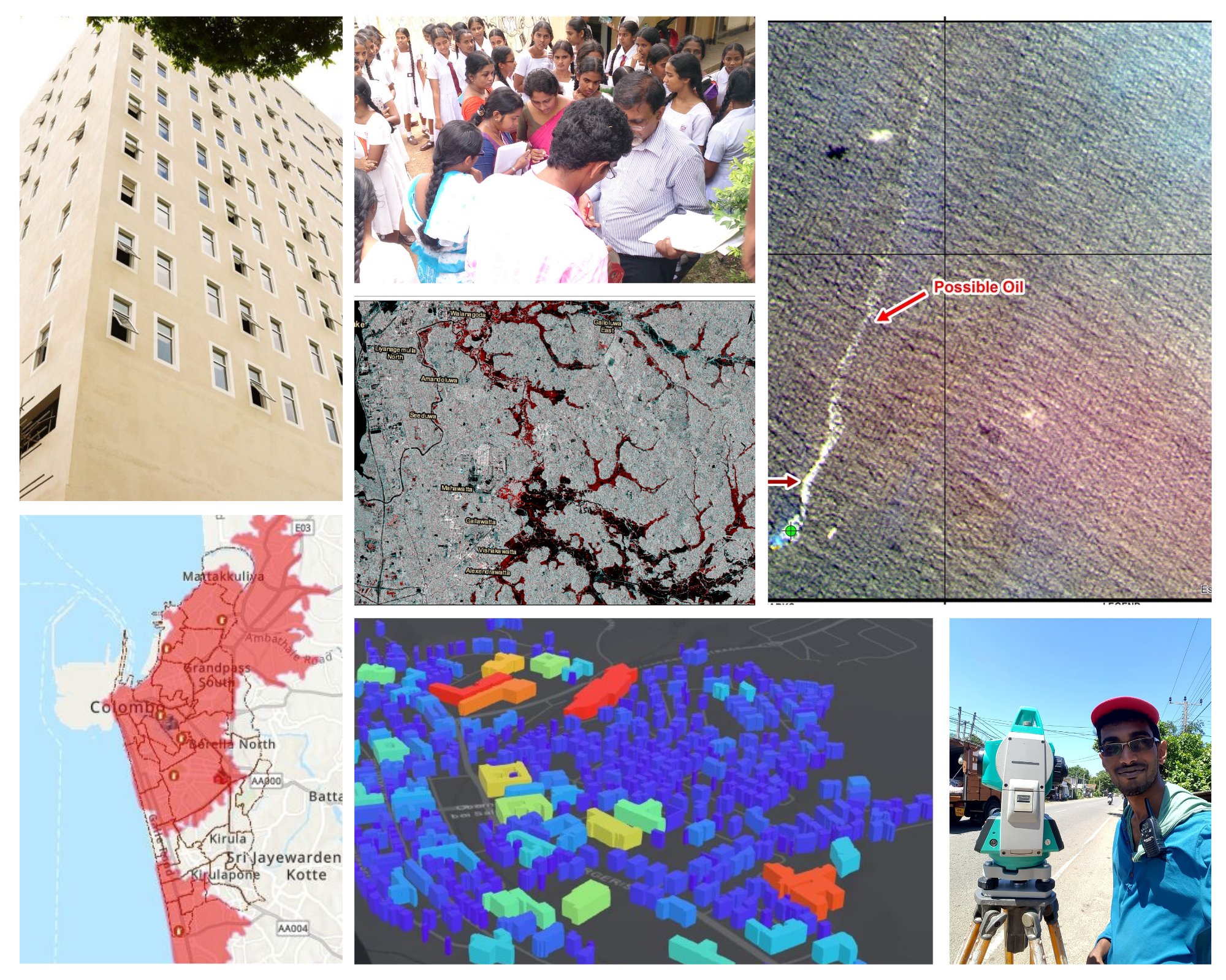
World From Space
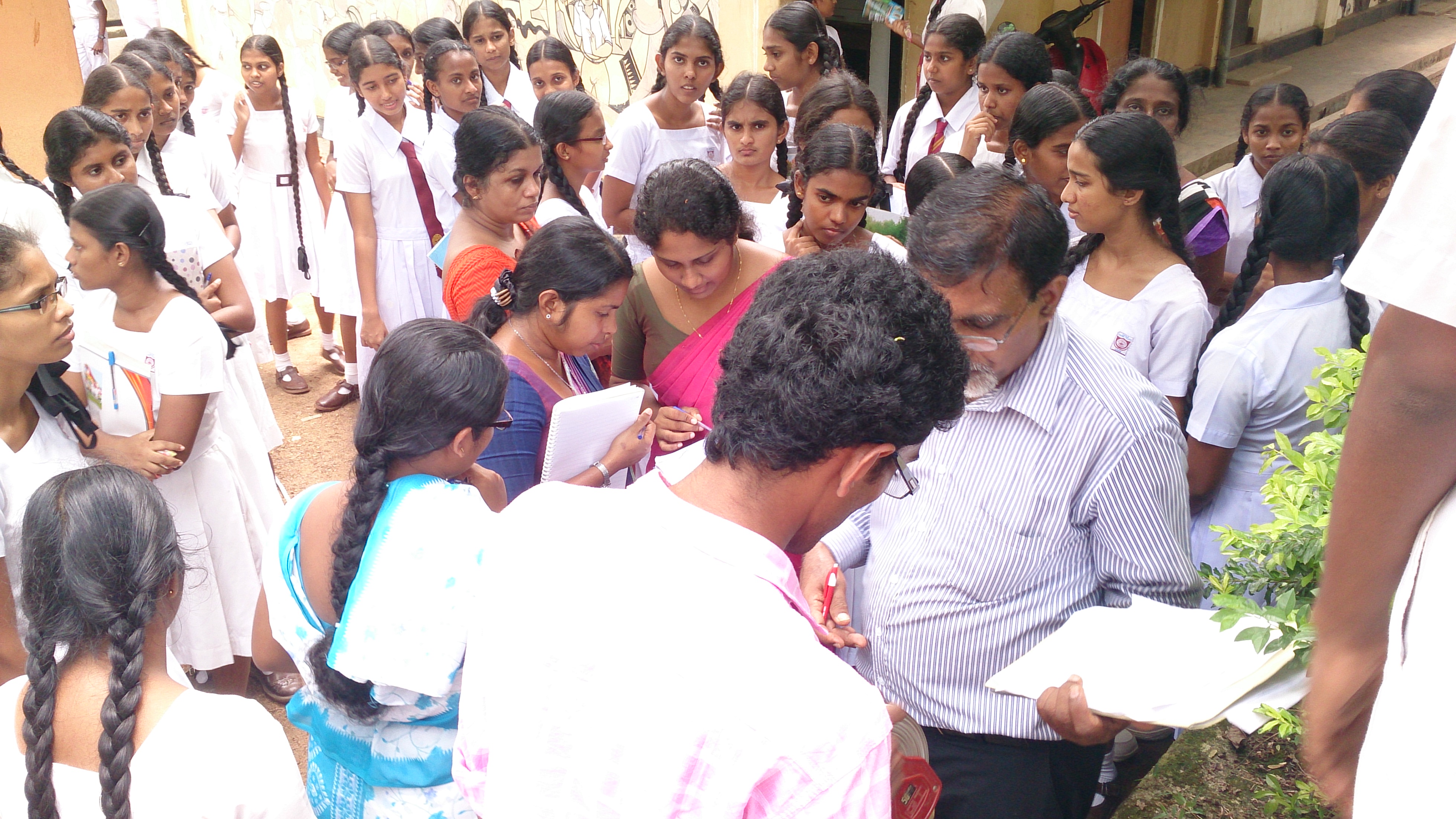
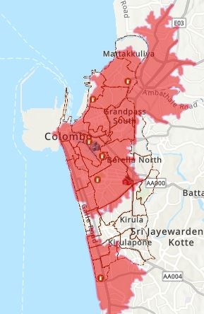
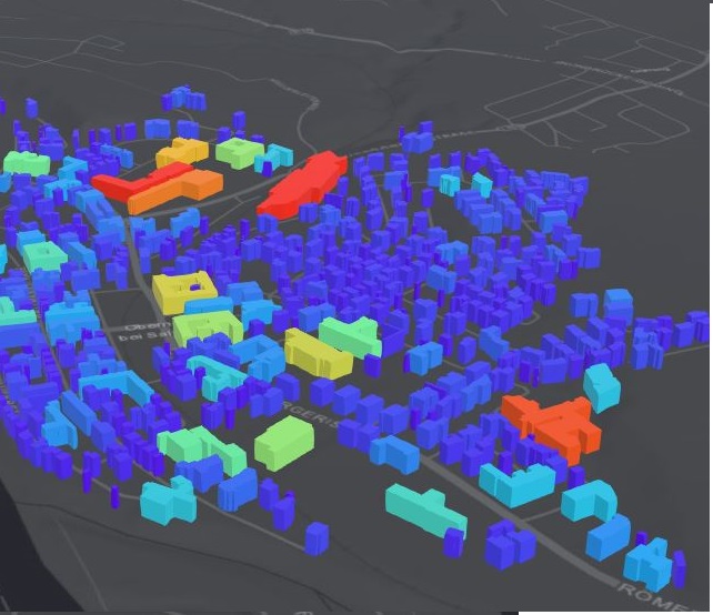
Geospatial Internship
During my tenure at World From Space, I delved into the world of high resolution satellite imagery, data analytics, and vegetation detection. This endeavor not only deepened my understanding of Earth observation but also underscored the vital role that remote sensing plays in promoting sustainable urban development.
Explore -

Palacky University of Olomouc
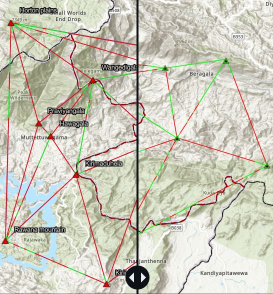
Vintage Map Poster
Embark on a journey through Sri Lanka's rich history with our captivating vintage map poster. From ancient civilizations to colonial eras, this meticulously crafted piece offers a visual narrative of the island's cultural heritage, perfect for history enthusiasts and admirers of timeless design.
Explore -
World From Space
Geospatial Internship
During my tenure at World From Space, I delved into the world of high resolution satellite imagery, data analytics, and vegetation detection. This endeavor not only deepened my understanding of Earth observation but also underscored the vital role that remote sensing plays in promoting sustainable urban development.
Explore -
Palacky University of Olomouc
Vintage Map Poster
Embark on a journey through Sri Lanka's rich history with our captivating vintage map poster. From ancient civilizations to colonial eras, this meticulously crafted piece offers a visual narrative of the island's cultural heritage, perfect for history enthusiasts and admirers of timeless design.
Explore -
World From Space
Geospatial Internship
During my tenure at World From Space, I delved into the world of high resolution satellite imagery, data analytics, and vegetation detection. This endeavor not only deepened my understanding of Earth observation but also underscored the vital role that remote sensing plays in promoting sustainable urban development.
Explore